Wednesday, November 27, 2013

Happy Thanksgiving


With the Thanksgiving Holiday once again upon us TWIPA returns this week with a post focused on one of everyone’s favorite topics, food. Foodways, or subsistence strategies, have long been a topic of interest and study of anthropologist and archaeologists. By quantifying the number and types of food remains, archaeologists can determine the percentage of different types of plants and animals harvested.

The State Museum of PA’s Section of Archaeology receives a steady flow of artifact collections as a result of Cultural Resource Management project surveys and excavations.  A recently submitted project involving highway improvements in Montgomery and Philadelphia Counties recorded four dozen, mostly 19th Century domestic sites. As a part of the project’s phase II workplan, diet and consumer behavior were identified as potential research issues for two of the sites that were considered potentially significant.

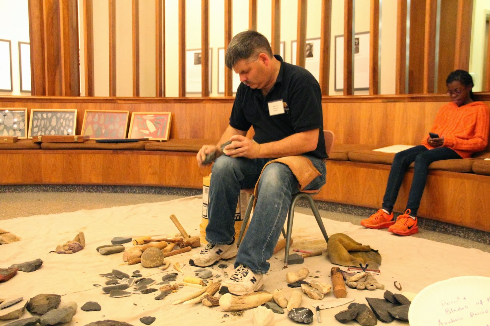
typical project area view, with orange flags marking shovel test pit locations

 In his report to PennDoT, Gary Coppock, working at the time for Archaeological & Historical Consultants, noted, “Archaeological remains can be analyzed for indications of the patterns of purchasing and consumption of goods by site occupants. Analysis of faunal remains may show the extent to which wild or domestic animals contributed to the diet, whether the animals were slaughtered at the site, and the economic and dietary value of meats consumed by site occupants (Coleman et al. 1984). Ceramic analyses can also contribute to the understanding of food consumption habits. A comparison of the relative frequency of flatware and hollowware forms, for example, has been used to infer the quality of meats used and in what form they were consumed (Kelso 1984)."

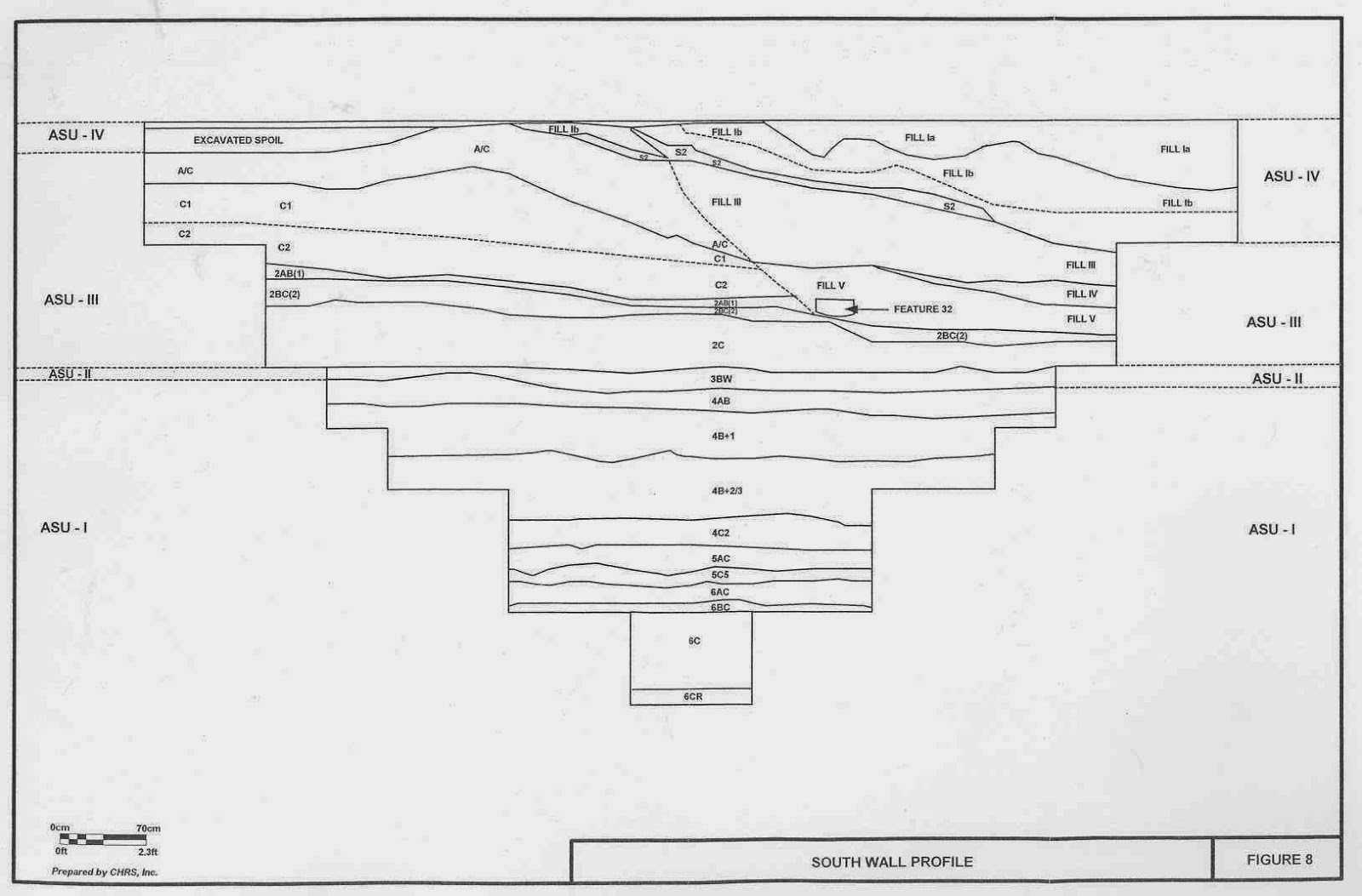
Excavation Unit profile from Woodhaven Road Extension Project

 Stepping back in time, the evolution of foodways began with small populations of Paleoindian hunters and gatherers exploiting an ice age landscape. Although the quantity of foods was relatively low, human population was also low and they did not need to develop special 
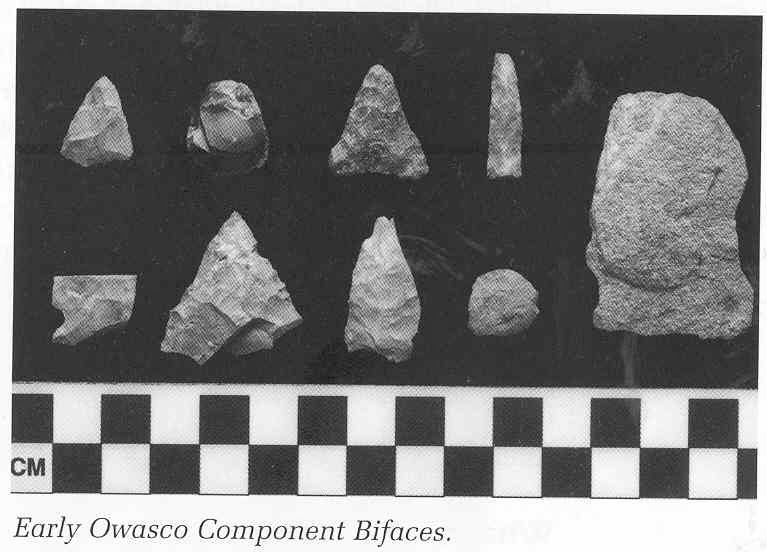
tools or organize a labor force to support themselves. The Archaic Period represents a plentiful time and human populations quickly grew by efficiently using all available resources. People developed many new tools to maximize their collection of food from the environment. As human populations increased, they began to exhaust the foods of the temperate forest and were forced to cultivate plants.

 Native American social organization began to change. Humans became more sedentary and eventually focused on farming to support increasing populations. Social structure changed to a tribal organization in order to better organize the labor force necessary for swidden agriculture of corn, beans and squash, often referred to as the Three Sisters. Both the nature and timing of the arrival of these domesticates into the Mid-Atlantic region continue to be intensively studied research topics in archaeology.
 
Each of the “Sisters” arrived in the Northeast at different points in time, with squash (Cucurbita pepo) being the earliest at between 5000 and 2500 years before present (Hart and Sidell 1997).  Next, corn, or maize, (Zea maize) becomes common in archaeological settings post-dating roughly 1200 B.P., or about A.D. 700 (Klein 2003).  And last to appear in the archaeological record is the common bean (Phaseolus vulgaris), at approximately A.D. 1300 (Hart and Scarry 1999). The application of C-14 and AMS techniques has proved to be indispensable tools for dating these and a wide variety of other botanical remains.

Requiring magnification, smaller evidence such as pollen, starch grains, and phytoliths can be used to identify plant species beyond the three typical domesticates. These types of analyses can not only help to identify dietary components of an archaeological site, but also aid more broadly in paleoenvironmental reconstruction. 

Along with zooarchaeological analysis of faunal remains, proteins recovered from the residue on cookware can be analyzed to identify groups of animal species and in some instances specific species. All these techniques aid the archaeologist in creating a more detailed picture of the past, in this case concerning just exactly what ingredients were used in preparation of a meal.

We hope this brief overview of foodways and food remains analysis wets your appetite for an enjoyable Thanksgiving meal with family and friends.

References:

Coleman, Ellis C., Kevin W. Cunningham, Jim O’Connor, Wade P. Catts, and Jay F. Custer
1984     Phase III Data Recovery Excavations of the William M. Hawthorn Site (7NC-E-46), New Churchman’s Road, Christiana, New Castle County, Delaware. Delaware Department of Transportation Archaeological Series No. 28, Dover.

Coppock, Gary F.
2002    Phase I and II Archaeological Survey Report Woodhaven Road Extension Project (S.R. 0063 Sections A06 & A07) Montgomery and Philadelphia Counties, Pennsylvania  - prepared for the Pennsylvania Department of Transportation Engineering District 6-0

Hart, John P. and C. Margaret Scarry
1999   The Age of Common Beans (Phaseolus vulgaris) In the Northeastern United States. American Antiquity 64 (4) 653- 658

Hart, John P. and Nancy Asch Sidell
1997   Additional Evidence for Early Curcurbit Use in the Northern Eastern Woodlands East of the Allegheny Front. American Antiquity 62 (3): 523-537

Kelso, William M.
1984    Kingsmill Plantation, 1617-1800: Archaeology of Country Life in Colonial Virginia. Academic Press, New York.

Klein, Michael
2003   Of Time and Three Rivers: Comments on Early and Middle Woodland Archaeology in Pennsylvania. In Foragers and Farmers of the Early and Middle Woodland Periods in Pennsylvania, edited by Paul A. Raber and Verna L. Cowin, pp. 117-129.  Recent Research in Pennsylvania Archaeology, No.3, Pennsylvania Historical and Museum Commission, Harrisburg, PA


For more information, visit PAarchaeology.state.pa.us or the Hall of Anthropology and Archaeology at The State Museum of Pennsylvania .

Friday, November 22, 2013

Workshops in Archaeology Review


If you are a frequent follower of This Week in Pennsylvania Archaeology, you would know that this past Saturday, the Section of Archaeology of the State Museum of Pennsylvania hosted its annual Workshops in Archaeology program. The theme of this year’s program was the Archaeology of a Troubled Nation 1775-1865. This all day event was comprised of a series of PowerPoint lecture presentations. Based on the Evaluation Questionnaire, this year’s program proved to be informative and entertaining for all whom attended.


Noel Strattan and Tom Held of the Bureau for Historic Preservation were on hand to guide people through the inner workings of the Cultural Resource Geographic Information System, or CRGIS web portal. Doug McLearen and Kira Heinrich, also of the BHP, were available to identify all manner of historic and prehistoric artifacts that might have been puzzling their discoverers.


The program was fortunate to also include Civil War reenactor John Heckman. John showcased the uniform and equipment of a common Pennsylvania soldier and fielded questions from the inquisitive.


Steve Nissley, an expert flint knapper, set up a lithic tool production workshop outside of the Auditorium. Steve’s demonstration is always well received and much appreciated, as seen here by some of our younger participants.


The morning began with opening remarks delivered by the Director of the State Museum of Pennsylvania, David Dunn, followed by four PowerPoint lectures focused on 18th century aspects of the workshop’s theme.


Wade Catts of John Milner & Associates relayed his experience using a type of remote sensing technology called ground penetrating radar, or GPR, to aid in the search for the remains of the Continental Powder Works and gun factory at French Creek, Chester County. The complex had played an active role in the American Revolution but was ultimately destroyed during the conflict. Wade explained how East Pikeland Township has taken an active role in preserving this unique piece of American history by securing a grant from the American Battlefield Protection Program.


Janet Johnson, Curator in The State Museum of Pennsylvania’ Section of Archaeology spoke about the recent discovery, subsequent local and state coordination, and ongoing conservation efforts to stabilize  a Revolutionary War relic known as a Cheval de Frise. A large number of these were placed in the Delaware River to thwart the advances of the British Navy during its attack on Philadelphia. Once this impressive 30 ft. long iron tipped “river spike” is preserved and exhibited, it will serve as an effective vehicle to connect people with the events of the American Revolution that took place in and around Philadelphia.


David Orr of Temple University discussed the work conducted work at Valley Forage National Historic Park. He explained how archaeological features recently discovered can transcend the well recited national historic mythologies of hardship and endurance of the winter of 1777-1778. Isolated trash pits, discrete cooking areas, and orderly arraignment of where the soldiers’ huts once stood illustrated the less well known stories of industriousness, effective leadership and disciplined training. These findings are now contributing to a greater depth of understanding of this critical point in the formation of our new nation.


Steve Warfel, retired Senior Curator of Archaeology at the State Museum of Pennsylvania, presented details of Ephrata Cloister’s use as a Revolutionary War hospital during 1777 – 1778. Through his extensive excavations of now extant dormitory and prayer buildings on the National Historic Landmark property, Steve has been able to tease apart military and medicinal artifacts of the hospital period from those more domestic in nature associated with religious community members. Thorough primary document research combined with a long term archaeology program have created a more accurate portrait of the past and corrected some secondary source romanticized histories of the Cloister.

Following a break for lunch, the four lectures presented in the afternoon continued with 19th Century aspects of the Workshop’s theme.


Walter Rybka, Senior Captain of the Flagship Niagara, walked the audience through an hour by hour timeline of the Battle of Lake Erie in 1813, a brief yet powerful conflict on Pennsylvania’s Great Lake. He also outlined the history of a series of reconstructions made of the war vessel, including his time and experiences as Captain of the current ship. Today, the Niagara is a high caliber combination living history museum and sailing ambassador of the Commonwealth.


Mary Ann Levine of Franklin and Marshal College shared her findings from excavations at the Thaddeus Stevens and Lydia Hamilton Smith site, located in the historic district of Lancaster City, Pennsylvania. A curious modification to a cistern coupled with oral histories and documentation of Stevens as a prominent abolitionist suggest this site might have been a place of refuge along the Underground Railroad. The nature of the function of such sites makes their positive identification a rare occurrence.


John Roby of Indiana University of Pennsylvania offered his listeners the notion of how a nuanced social context has the potential to lead to a refined interpretation of archaeological remains.  Ideas concerning social justice and resistance through conscientious consumerism were introduced through the example of the Free Sugar Movement of the mid – 19th Century. This social lens was then applied to the archaeology of a multi-generational maple sugar production farm owned by an African American family in Susquehanna County.


Ben Resnick from GAI Consultants discussed the accidental discovery, analysis and re-burial with military honors of a civil war soldier who had been killed during the first hours of the battle of Gettysburg.  Using battle records he was able to lay out the proceedings of the morning in the area known as the ‘railroad cut’, where the remains had been found.  Forensic archaeology then made it possible to surmise a plausible end to this brave soldier’s life. Current research has narrowed the personal identification of this individual to one of about 30 candidates, and future research using DNA may be able to establish his identity.  As for now he has been reburied with high honors as “Unknown Civil War Remains”.


 Following the final presentation, Judd Kratzer remarked on how each of the projects featured during the program had contributed to our greater understanding of the conflicts represented in the time period under discussion through archaeology field work and analysis of material culture. There was also a brief question and answer period to afford attendees the opportunity to pose specific comments or questions to the presenters.The day’s events concluded with a casual wine and cheese reception in the Archaeology gallery.


We would be remiss if we did not mention and thank our dedicated group of volunteers who helped in all manner of ways, both in front of and behind the scenes. We would not be able bring this event together without your assistance. A special thanks to Judy Hawthorn who took pictures all day long of the event.

Already looking ahead to next year, the Workshops in Archaeology program is scheduled for Saturday November 8th, 2014. The theme will be the Paleo-Indian time period and Ice Age peoples’ adaptations to a changing climate and environment.

For more information, visit PAarchaeology.state.pa.us or the Hall of Anthropology and Archaeology at The State Museum of Pennsylvania .

Friday, November 15, 2013

Union County


This week in Pennsylvania Archaeology takes us to Union County located near the heart of central Pennsylvania. In 1813 Union County was formed from part of Northumberland County allowing for a living area of 317 square miles. The 2012 the census records reports a population of 45,000 people living there and Lewisburg is the county seat.

Two physiographic sections make up Union County. The eastern half is within the Susquehanna Lowlands while the western half is comprised of the hills and ridges of the Appalachian Mountains. Elevations range from a low of 938 feet in the valleys to a high of 1443 feet on the highest ridge tops. Both Sections form a large part of the Ridge and Valley Province of central Pennsylvania where the climate is temperate and largely pleasant year round.

The bedrock in Union County was formed from Ordovician, Devonian and Silurian sediments (365-500 million years old). The bulk of the county’s bedrock however, is made up of the 405-430 million year old Silurian Period material. The remains of many fossilized plants and animal fauna have been found in the strata of these rocks which are among some of the finest preserved in the Commonwealth. The Faylor-Middle Creek Limestone Quarry at Winfield contains some of the best calcite, fluorite and strontianite crystal specimens that have been identified by Pennsylvania geologists (Geyer et al. 1976). Additionally, there are massive chert bearing deposits in the Penns Creek drainage that were exploited for stone tool material by different prehistoric Indian cultures (Bressler 1960).   

The principal drainage of Union County is the Susquehanna’s West Branch where its tributaries are east trending. Buffalo and Penns Creek are the main secondary water sources. The former enters the West Branch at Lewisburg and the latter continues on its southern course to enter Middle Creek south of Selinsgrove, Pennsylvania.

Three Indian paths ran through Union County. The Great Island Path skirted the northern part of the county and connected Great Island at Lock Haven with Shamokin at the Forks of the Susquehanna at Sunbury. An unnamed secondary path connected Great Island with the Penns Creek Path at Millheim, Pennsylvania on Penns Creek. Along the southern border of Union County ran the Penns Creek Path which also converged at the 18th century Shamokin Indiantown once located at the Forks of the Susquehanna at Sunbury.

A review of the Pennsylvania Archaeological Site Survey (P.A.S.S.) files identified 142 recorded archaeological sites. Of these, 37 are Historic and the remainder are Prehistoric. Most of the Historic sites are 19th century in age, however, the reported prehistoric sites are representative of all the recognized cultural periods in Pennsylvania, from Paleoindian through the Late Woodland. In terms of site type, the majority are Late Woodland (25%) and Late Archaic (22%) in that order of frequency. Transitional sites (16%) are followed by Middle Archaic sites (14%) then Early Woodland at (7%). Next are Middle Woodland (5%) and Paleoindian sites (5%) and ending with four Early Archaic Period sites at (4%). Not unexpected, the primary choice of lithic material for tool manufacture are local source cherts from the Keyser/Shriver formations that occur in eroded outcrop and cobble locations in  much of Union County. As well, open pit quarries are reported from certain sections of the county.

The Bloomer Site (36Un82)


Excavation block profile (36Un82)

One of the principal cultural resource data recovery projects in Union County was undertaken and completed in 1992 for U.S. Department of Justice Federal Bureau of Prisons (Wall 1995). The project, located on a Holocene/Pleistocene terrace on the West Branch Susquehanna River at Allenwood, Pennsylvania, is a stratified prehistoric site. The site, designated in the PASS files as 36Un82 is multi-component with Late Archaic, Transitional (alternatively called Terminal Archaic by the investigators of the report), Early Woodland and early Late Woodland (Clemson Island) period occupations.

Lamoka projectile points from the Bloomer Site (36Un82)

The deepest cultural level occurring at 36Un82 is 3Ab associated with the Lamoka phase of the Late Archaic Period (Ritchie 1965; Funk 1993).  Four hearth features from a living floor date the Lamoka occupation(s) between 2950 BP and 3970 BP.  The 2950 B.P. radiocarbon date seems too late in time for this occupation, therefore the remaining cluster of four dates which averaged out at 3820 B.P. indicate an approximate site occupation by Lamoka phase people around 3800 B.P.

Broadspears from the Bloomer Site (36Un82)

The Transitional Period Broadspear phase occupation(s) was identified immediately above the Lamoka levels of 2Bwb and occasionally co-mingled with younger Early Woodland Period Fishtail and Meadowwood phase points that had apparently made their way into the deeper Broadspear phase level from the Bwb. Three radiocarbon dates from hearth contexts suggest an occupation(s) range for this component between 2900 BP and 3640 B.P., but again, by eliminating the youngest of the three dates (the 2900 date) which appears to be an outlier, an averaged date of the actual Broadspear occupation would have been around 3610 B.P.

Fishtail projectile points from 36Un82

Triangle projectile points from 36Un82

It is unfortunate that there were no radiocarbon dates linking the site’s cultural chronology in the next upper level designated as 2Ab. This was the site’s uppermost intact level containing the Fishtail phase and Meadowood phase points. However, the outlier date noted for the Late Archaic date cluster seems closer to the Early Woodland and may in fact date that occupation at 36Un82. Typically, these occupations at other Susquehanna Valley sites date between 2500 B.P. and 2200 B.P. - not that far temporally removed from the aforementioned 2900 B.P. date.

Plan view of Clemsons Island house structure

The uppermost deposit at 36Un82 designated as Bwb contained pit and postmold features representative of the Late Woodland Clemson Island phase. This and its Early Owasco counterpart are the dominant cultural expressions thus far recognized for the entire West Branch valley (Turnbaugh 1977). Features of the Clemson Island phase were prolific at site 36Un82 and largely consisted of hearths, refuse and storage pits containing cultural debris such as decorated grit tempered pottery, broad based triangular points and numerous cobble tools commonly associated with lithic reduction and food preparation activities. The majority of these features are likely linked to the remains of an adjacent longhouse. Associated radiocarbon dates place the occupation between 970 and 1070 B.P. The assumed date of occupation is the average of the two dates or 1020 B.P.

We hope that you have enjoyed this brief introduction to the archaeology of Union County and we encourage you to consult the Reference Section of this TWIPA submission for further information on Pennsylvania history and archaeology of the cultures that once lived here. 

Mark your caledar!
The State Museum of Pennsylvania's Section of Archaeology will be hosting its Annual Workshops in Archaeology on Saturday November 16, 2013.  This year's theme is the Archaeology of a Troubled Nation, 1775-1865.  As always, lectures will be presented by professionals from throughout the region as well as artifact identification in the afternoon, so don't forget your "what's this".  This year will also include John Heckman, a Civil War reenactor who will showcase the uniform and equipment of a common Pennsylvania soldier during the American Civil War.  A reception in the Hall of Anthropology and Archaeology will conclude the event.  Click here to see the brochure which includes all the details.


                                                          References
Bressler, James P.
1960       The Penns Creek Archaic Workshops. Pennsylvania Archaeologist 30(1):25-29.

Funk, Robert E.
1993       Archaeological Investigations in the Upper Susquehanna Valley, New York State. Two volumes. Persimmon Press Monographs in Archaeology.

Geyer, Alan R., Robert C. Smith and John H. Barnes
1978       Mineral Collecting In Pennsylvania. Department of Environmental Resources Topographic and Geologic Survey. Harrisburg.

Ritchie, William A.
1965       The Archaeology of New York State. The Natural History Press, Garden City, New York.

Turnbaugh, William A.
1977       Man, Land and Time: The Cultural Prehistory and Demographic Patterns of North-Central Pennsylvania. Unigraphic Press, Evansville, Illinois.

Wall, Robert D.
1995       Phase III Archaeological Investigations 36UN82 Union County, Pennsylvania. ER#89-1630-119. Allenwood Pennsylvania Federal Correctional Complex Sanitary Water treatment Facility. Louis Berger & Associates, Inc. Report prepared for the U.S.Department of Justice, Federal Bureau of Prisons. Washington D.C.

Wallace, Paul A.W.

1965       Indian Paths of Pennsylvania. Pennsylvania Historical and Museum Commission. Harrisburg.


For more information, visit PAarchaeology.state.pa.us or the Hall of Anthropology and Archaeology at The State Museum of Pennsylvania .

Friday, November 8, 2013

Tioga County


This week in Pennsylvania Archaeology takes us to Tioga County situated at the northern border of Pennsylvania. Surrounded by Potter, Lycoming and Bradford counties and the New York state border, Tioga is noted for its many State and National parks and numerous lakes where residents and visitors alike enjoy its captivating natural beauty. Segments of the 50 mile long Pennsylvania Grand Canyon west of Wellsboro and the Pine Creek Rail Trail wind through Pine Creek gorge and connect with the Susquehanna’s West Branch River valley at Jersey Shore, Pennsylvania.

Tioga County, formed from part of Lycoming County in 1804 takes it name from the Tioga River. It has a total land surface of 1137 square miles and Wellsboro is the county seat. Much of Tioga County remains rural and is the perfect setting for the State’s annual Laurel Festival held each Spring. The main corridors, 6, 287 and 15, connect much of the countryside with the more urban towns such as Mansfield, and home to Mansfield University of Pennsylvania.

Pennsylvanian, Mississippian and Devonian rocks constitute the geological makeup of Tioga County and originally these rocks were a part of the vast sea sediments that formed some 290-405 million years ago. Tioga County is located in the Glaciated High Plateau, Glaciated Low Plateau and Deep Valleys Sections of the Appalachian Plateau Province. These physiographic land forms are characterized by eroded hills and generally narrow, steep sided valleys.  The major streams are the Cowanesque and Tioga Rivers that form as major waterways of the Chemung and the Susquehanna’s North Branch drainage.

According to Paul Wallace (1971) three major Indian paths cut through Tioga County. The Pine Creek Path which followed the gorge through the Pine Creek valley connected Quennashawakee Indiantown with the Forbidden Path at Genesee. The Tioga Path ran from French Margaret’s Town at present day Williamsport to Painted Post where it connected with the Forbidden Path. A third path branched from the Tioga Path and joined with the Horseheads Path at present day Canton then east to Towanda Indian town on the North Branch at Towanda, Pennsylvania. These paths were most certainly important trailways throughout prehistory since they all followed less rugged terrain along north to south and south to north flowing waterways.

The Pennsylvania Archaeological Site Survey (P.A.S.S.) files list 163 prehistoric and historic period sites for Tioga County. Of these, the majority (99) have prehistoric components while the remaining (historic in age) constitute remnants of domestic dwellings/rural farmstead and a few commercial and industrial sites principally relating to a 19th and 20th century origin.

Survey data for settlement patterns is largely riverine/lowland  with 103 of the 163 of the reported sites grouping into this category. The remaining 46  sites relate to an upland setting environment where small first and second order streams dominate the landscape. Along with this data the PASS files also show an expected trend for the prehistoric utilization of cherts/flints over jasper, rhyolite and quartz simply due to the availability of these glacially derived lithics from valley terrace  and stream outwash deposits. Such lithic cobble sources would have been readily quarried from these locations throughout Tioga County.
The prehistoric record, as shown by the PASS data, indicates that an overwhelming number of Late Woodland, Transitional and Middle Archaic period sites outnumber sites from the other periods. This is especially puzzling given the pervasive nature of Late Archaic Period sites versus Middle Archaic Period sites reported for other parts of northern Pennsylvania and southern New York State.

Archaeological excavation of Owasco house pattern

Planview of Owasco house pattern

There has been a number of cultural resource surveys conducted in Tioga County, Pennsylvania, however, for this report, only one will be summarized here. Data recovery activities at the Mansfield Bridge Site 36TI116, by Louis Berger Group, Inc., was undertaken as the result of a proposed relocation and alignment of State Route (SR) 6015 at Canoe Camp located south of Mansfield. The study resulted in the discovery and recovery of new information pertaining to the prehistory of the Tioga River valley from the Middle Archaic period through the beginning of the Late Woodland period. 

The deepest human occupation level at Mansfield Bridge site contained remnants of a small camp used by Middle Archaic people.  Within this level, archaeologists discovered bifurcate points, debris from manufacturing and re-sharpening these points and hammerstones made from river cobbles. Scattered amongst this debris lay poorly preserved bone fragments , likely the skeletal remains from game animals. Several small charcoal stained hearths that were also discovered yielded a radiocarbon age between 7610-8150 BP.

Above the Middle Archaic level at the Mansfield Bridge Site archaeologists discovered a cultural occupation sealed in alluvium that dated to the Late Archaic Period at 5100-5400 BP. There, the projectile point forms were identified as Brewerton side-notched, a common point type found in this region of the Northeast. The small size of the hearths, the presence of other objects such as uniface tools, waste flakes and a cluster of cobble tools suggested a site use as a lithic workshop revisited during brief hunting and gathering excursions into the Tioga River valley.

Following the Late Archaic visitations, the site was utilized as a short term camp by Transitional Period groups as was indicated by the presence of rhyolite and jasper bifaces and chipping debris of Susquehanna and Perkiomen Broad spearpoint types and hammerstones. A radiocarbon date of ca, 3500 BP., was obtained from a small hearth associated with these tools.


An alluvium deposit capped these earlier non-ceramic bearing occupations at the Mansfield Bridge Site. A Late Woodland Owasco phase component with a postmold pattern of a small square-shaped house 25 by 20 feet in size and pit features surrounding it were identified during the data recovery project. The occupation was radiocarbon dated to 1000 AD. Chert triangular points, diagnostic cordmarked pottery and fragments of smoking pipes link the occupation to the earlier part of the Owasco Carpenter Brook phase (Ritchie 1965).  Other sites of this phase in New York and the Susquehanna valley of Pennsylvania have been radiocarbon dated between  1000-1100 AD.

Example of the Mansfield Bridge Site (36Ti116) stratigraphy

Excavation Unit 24 profile with cultural levels 

We hope you have enjoyed this archaeology tour through of Tioga County and please join is next week when we will journey to Union County.

References:

Ritchie, William A.
The Archaeology of New York State. Natural History Press, Garden City, New York.

Wall, Robert D., Rick Vernay, Delland Gould and Hope E Luhman
2003       Hunters to Horticulturists: The Archaeology of the Mansfield Bridge Site. SR 6015, Section D52 Tioga County, Pennsylvania. Report submitted to the Pennsylvania Department of Transportation, Engineering District 3-0, Montoursville, Pennsylvania.

Wallace, Paul A.W.

1971       Indian Paths of Pennsylvania. Second Printing. The Pennsylvania Historical and Museum Commission, Harrisburg.


For more information, visit PAarchaeology.state.pa.us or the Hall of Anthropology and Archaeology at The State Museum of Pennsylvania .

Friday, November 1, 2013

Susquehanna County


This Week In Pennsylvania Archaeology takes us to Susquehanna County located in the hilly region of northern Pennsylvania. Susquehanna County was established in 1810 from lands claimed by Luzerne. Named after the Susquehanna River, it has a total area of 832 square miles and it is this drainage that winds its way south, where it eventually drains to Chesapeake Bay at Port Deposit, Maryland. Secondary drainages flow to the north and south and include Tunkhannock, Meshoppen, Wyalusing, along with many of the Susquehanna’s smaller tributaries. They join the main North Branch channel at different locations in the county.

Susquehanna County is within the Glaciated Plateau Section of the Appalachian Plateaus Province. The physical landforms are characterized by gentle to moderately rolling hilly uplands, ridges with narrow valleys typical for the general configuration of the Glaciated Plateau in east-central Pennsylvania. Geologically, Susquehanna County is made up of sandstone and shale deposits of the Devonian period (365 – 405 million years old). Fossilized animal remains include brachiopods and crinoids from long ago. The ridges all around the county are capped with weather resistant sandstone and softer rocks such as siltstone and shale. During the Pleistocene period Susquehanna County was covered by a series of thick ice mantles. Along the main and secondary valleys are the residual sediments from glacial activity consisting of glacial cobbles, sand and pebble deposits.  These residual deposits, which are quite abundant in the county, have been mapped by the Pennsylvania Geological Survey and have been commercially mined for road base material.

The only Indian path that ran through Susquehanna County was the “Lackawanna Path”. Prior to, during, and after the 18th century, this path joined with others to form an elaborate complex of trails connecting different parts of the Pennsylvania landscape (Wallace 1971). Although there are no reported Indian towns along these routes, they connected Indian towns at each end, namely Lackawanna and Capoose Meadows near Scranton to Tuscarora Town at present day Lanesboro on the the Great Bend of the Susquehanna, near the New York State border. Of note here, is the observation that a segment of Interstate 81 follows the general route of this ancient Indian path between these two locations.

view of the bridge replacement project area at
 Hallstead, Susquehanna County

A review of the Pennsylvania Archaeological Site Survey (P.A.S.S.) identifies 143 prehistoric and historic period sites in Susquehanna County, which accounts for a site density of one site for every 5.83 square miles. The majority of these sites fall into one or more of the seven prehistoric periods, with the Transitional accounting for most. Trending in highest site frequency to least, Transitional Period sites are followed by Late Woodland, Late Archaic, and Middle Woodland Period sites. Middle and Early Archaic sites are rare. In terms of site setting, the most recorded are situated along valley floors adjacent to large perennial water sources such as rivers and second order streams. Thirty three of the prehistoric sites occupy upland settings where the water systems are smaller, often consisting of low volume seeps and springs. Lithics used in the manufacture of projectile points and cutting tools are principally made from cobble cherts, granites and indurated sandstone/siltstones from the eroded glacial deposits within the valley. Reported Historic Period sites are largely comprised of rural farmsteads, house sites, remnants of related out building structures and bridges.

plan view of features within upper levels of the Keystone Farm Site (36Sq17)

In 1999 the Federal Highway Administration/PennDot and archaeological consultants conducted a geo-archaeological and Phase I/II and III archaeological study at Hallstead, Susquehanna County. This investigation was in preparation for a proposed bridge relocation on the “Great Bend” of the Susquehanna River. These investigations identified a deeply stratified multi-component site containing prehistoric occupations with various projectile points, scrapers, utilized flakes, pottery and fire cracked rock. Many of these objects date from the Middle Archaic Period through the Late Woodland Period. The Pennsylvania Archaeological Site Survey file lists the site as 36SQ17.

profile of excavation block at the Keystone Farm Site (36Sq17)

Some of the pit and post mold features in the upper strata  at 36SQ17 containing fragments of Owasco pottery and triangular projectile points were radiocarbon dated between 1060 BP. and 940 BP, which suggests a site occupation around 1000 B.P. Preserved botanical remains included wood charcoal, nut shells, seeds and other unidentified (as to Genus and species) carbonized plant parts. Additionally, at the 2.63 meter depth and slightly deeper, two radiocarbon dates spanned a time between 4780 B.P. and 7630 B.P. Both dates fall within the range defining the Late Archaic and Middle Archaic Periods in the Northeast. There Vestal, and Brewerton points were recovered. 

line drawings of projectile points recovered from the Keystone Farm Site (36Sq17)

The older date may relate to a Neville phase occupation although that has not been confirmed with diagnostic artifacts. The deepest cultural level identified at the Keystone Farm Site, (36Sq17), was found at four meters below ground surface. Discovered within the sandy alluvium stratum, designated as “6BC,” were segments of a living floor that had been utilized by LeCroy phase people, around 8000 BP. In this deepest level at 36SQ17 one diagnostic biface, a Titicut point (LeCroy variant), was recovered with chert debitage and utilized flakes. Further analysis determined that the pattern of these artifacts suggests some sort of lithic workshop activity, possibly focused on late stage tool production or re-sharpening.

density map of debitage and tools from stratum "6BC" at the Keystone Farm Site (36Sq17)

 We hope you have enjoyed this brief introduction to Susquehanna County archaeology. Also, we encourage you to consider joining us at our annual Workshops in Archaeology program on November 16th to learn more about the archaeological heritage of Susquehanna County.  Dr. John Roby of Indiana University of Pennsylvania' s Department of Anthropology will present The Dennis Farm: Maple Sugar, Production and Politics in the 19th Century. This homestead has continuously belonged to the original African-American landowners’ family for over 200 years. Purchased with monies received for service during the Revolutionary War, preservation of this family homestead provides a unique opportunity to examine property held continuously by one family over multiple generations. The link for the registration form for the Workshops is in the upper right corner of this blog page; please remember the deadline for early registration is November 8th!

References:

Cultural Heritage Research Services, Inc.
2008    Archaeological Investigations S.R. 0011, Section 573, Great Bend Bridge Project, Susquehanna County, Pennsylvania. E.R.# 00-6202-115. Report prepared for U.S. Department of Transportation - manuscript of file at the Section of Archaeology, The State Museum of Pennsylvania

Wallace, Paul A. W.
1971    Indian Paths of Pennsylvania. Publication of the Pennsylvania Historical and Museum           Commission.


For more information, visit PAarchaeology.state.pa.us or the Hall of Anthropology and Archaeology at The State Museum of Pennsylvania .